

Crockauns [Na Crocain]
Good walks are even better shared.
Overview
Crockauns [Na Crocain]
Crockauns, or Na Crocain, is a Marilyn located in the scenic region of West Mayo, Ireland. Rising to an elevation of 637 meters, this mountain offers hikers a mix of challenge and breathtaking views. Whether you're a seasoned mountaineer or a casual walker looking to stretch your legs, Crockauns is an inviting destination.
Geology
The geology of Crockauns is primarily limestone. This type of rock forms the foundation of many stunning landscapes across Ireland and offers unique karst formations. As you climb, take notice of the rugged textures and distinct features that have evolved over millennia.
Routes
There are several routes to choose from. For those seeking a leisurely day out, the Crockauns Loop Trail is perfect. Stretching approximately 8.5 km, this route provides an enjoyable walk through meadows with a steady ascent to the summit. If you're feeling a bit more adventurous, the North Ridge Ascent is a challenging option that will push your limits while rewarding you with incredible panoramas.
Summit Features
Reaching the summit of Crockauns, you'll encounter a quaint cairn that serves as a milestone for hikers. Take a moment to rest and capture the expansive views. Remember, photos or it didn’t happen!
Terrain Type
Expect a mix of grassy areas and rocky outcrops, with patches of bog known for their charm… and their ability to swallow footwear unexpectedly. A sturdy pair of boots is recommended!
Views
From the summit, you can feast your eyes on the breathtaking Nephin Beg range and the sparkling Atlantic. Best seasons for clear views are late spring and early autumn when the wildflowers bloom, and the landscape is at its brightest.
Hazards
As with any mountain adventure, it's essential to be aware of potential hazards. Weather conditions can change suddenly; moreover, paths may be slippery, especially in damp conditions. Watch your step, and try not to give way to any overly enthusiastic bogs!
Access
Parking is available at the trailhead, and public transport options are limited, so having a vehicle can be beneficial. The closest town, Westport, is filled with quaint local shops and delightful cafes ready to replenish your energy post-hike.
Facilities
Cafes and toilets are readily available in Westport, making it a convenient base for your outdoor adventure. Make sure you indulge in a little refreshment after your hard work!
History
The Gaelic name 'Na Crocain' translates to 'the little ridges,' describing the terrain's undulating nature. This mountain is not only a haven for hikers but also holds cultural significance for the locals, steeped in folklore and tradition.
In conclusion, Crockauns [Na Crocain] is an enriching destination for those eager to explore Ireland's majestic landscapes. With a variety of routes, captivating views, and a touch of local culture, your hike promises to be both memorable and rewarding. Happy hiking!
Explore routes near Crockauns [Na Crocain]
Public walks starting within 80 km of this hill. Nearby does not mean a route reaches the summit; check its map and access before setting out.
Route planning notes
These notes describe possible approaches, not verified navigable routes or permission to cross land. Check current paths, local access rules and conditions before setting out.
Crockauns Loop Trail
A scenic route starting from the base of the mountain, winding through lush meadows before ascending to the summit.
North Ridge Ascent
This route takes you directly up the north ridge, offering a more challenging hike with stunning views along the way.
Make a day of it, together
Find someone to share the walk with, or organise a day out along a route you like.
Photo Gallery
View all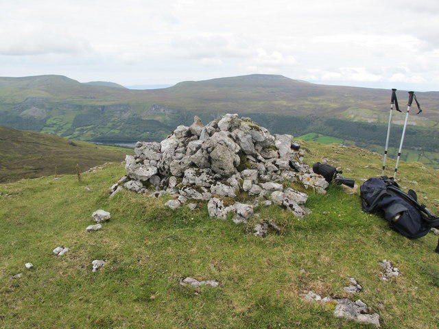 Photo could not load
G7540 : Leitrim: Crockauns Summit Cairn
Michael Murtagh
Hill facts and local notes
Classifications
Elevation
463m
1,519 ft
Prominence
386m
Coordinates
54.3171, -8.3701
G759409
OS Map
16
At the Summit
The summit features a modest cairn and dramatic views that gift photogenic moments for budding photographers and seasoned snap-happy hikers alike.
Terrain & Geology
Predominantly composed of limestone, Crockauns showcases classic karst features, including sinkholes and exposed rock faces that tell tales of a long geological history.
Views & Scenery
From the summit, one can gaze upon the majestic Nephin Beg mountain range, the shimmering Atlantic Ocean, and the picturesque countryside dotted with farms and forests.
History & Heritage
Name Origin
The name 'Crockauns' translates to 'the little ridges' in Irish, a fitting moniker for its stunning, undulating landscape.
Historical Significance
Crockauns holds cultural importance for the local community, often associated with folklore and local legends about the surrounding land.
Getting There & Facilities
Check current local access restrictions, parking rules and transport timetables before travelling. These notes do not confirm public access to the summit.
Parking
Parking is available at the foot of the Crockauns Loop Trail, with space for several cars. Arrive early to secure a spot, especially on weekends.
Public Transport
Local bus services operate from Westport to nearby villages, but a car is recommended for easier access to the starting points.
Nearby Facilities
There are cafes and shops in Westport, as well as public toilets located in the town. Be sure to grab a treat after your hike!
Safety Information
Known Hazards
- Be cautious of sudden weather changes, as conditions can shift rapidly. Improper footwear can lead to slips on the rocky paths, and beware of the playful bogs waiting to catch you off guard.
General Safety Tips
- Check weather conditions before setting out
- Carry appropriate clothing and equipment
- Let someone know your planned route
- Take a map, compass, and GPS device
- Carry emergency supplies: food, water, first aid kit, torch
Hills
Some common questions about the hills answered
Are there group walks up Crockauns [Na Crocain]?
Many walkers use Walkmates to join or organise walks with others. You can check for group walks around Crockauns [Na Crocain] through the maps
Are there other walkers around Crockauns [Na Crocain]?
Activity varies by location and time, but Walkmates lets you see whether others have shared walks or shown interest in this area. Find other people through the walking friends search walking friends for Crockauns [Na Crocain] search or of course create your own walk for Crockauns [Na Crocain]
Can I organise a walk to Crockauns [Na Crocain]?
Yes. If there aren’t any walks listed already, you can create a walk and make it available for others to join.
If you're signed up to Walkmates, you can create a walk to Crockauns [Na Crocain].
How do I find a walk up this hill?
There are often multiple ways to walk this hill, depending on experience and route preference. Walkmates helps you explore walks and routes that others have shared.
Can I suggest a new route up Crockauns [Na Crocain]?
Yes. You can suggest or create routes to share with others. Walkmates focuses on the social side of walking, so routes are used to help people organise walks and explore areas together, rather than as detailed navigation tools or route libraries.
Other uses really appreciate knowledgeable walkers sharing their routes. Share your favourite route to Crockauns [Na Crocain] here
The is an error or something incorrect about this hill. How do I let you know?
We always strive to keep the information on Walkmates as accurate as possible. If you find an error, please let us know through the contact form and we'll aim to correct it as quickly as possible
Community Discussion
Comments
Location
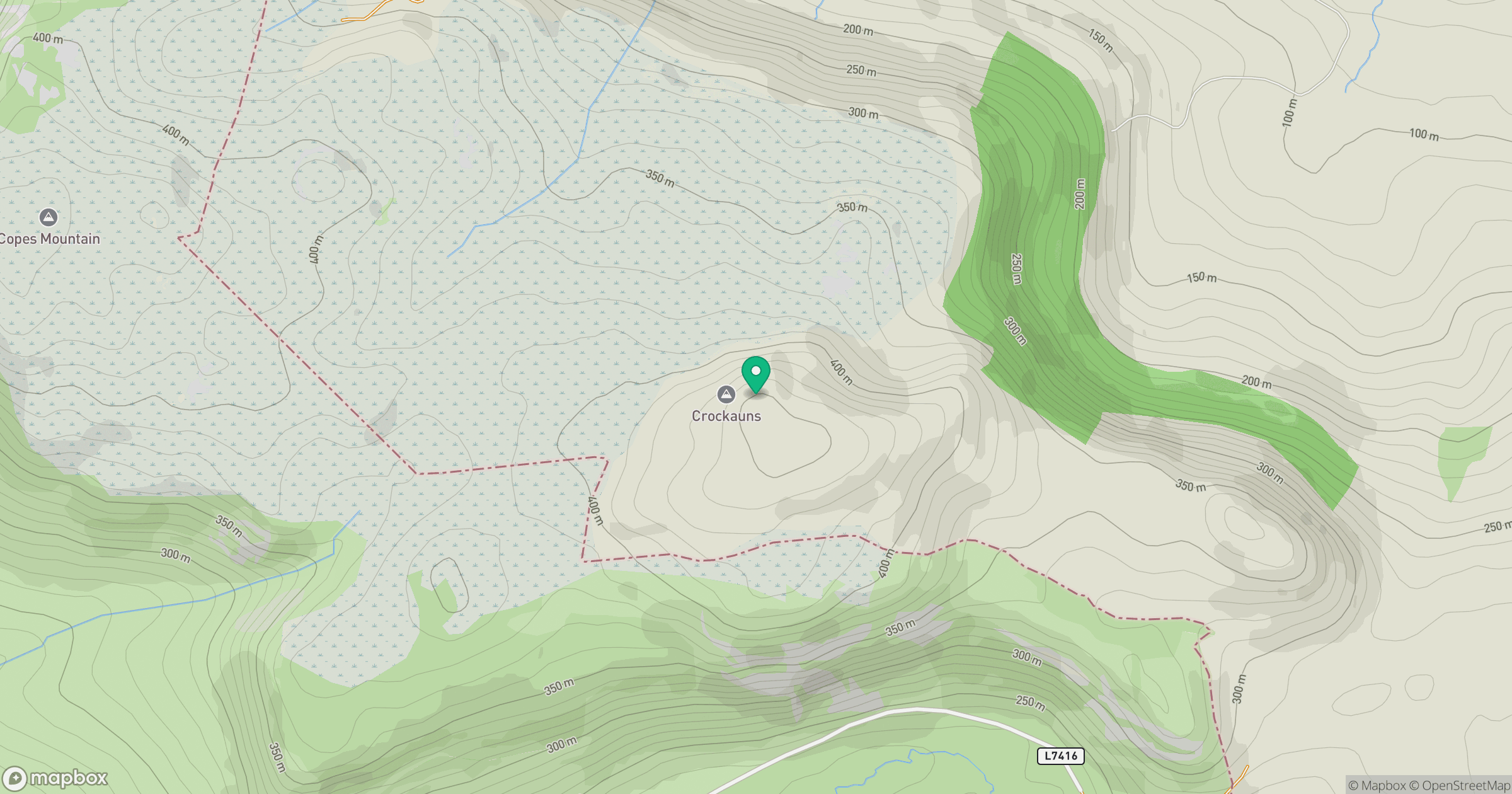
Grid reference: G759409
View on OpenStreetMapOpens a map in a new tab, centred on the hill.
Hills within 30 km
Straight-line distance, not a walking route or confirmation of access.
No comments yet. Be the first.